The following information was provided by Mike Dutter of the
National Weather Service in Wakefield:
“Good Morning - Attached
is the a briefing for Hurricane Matthew. Based on the latest track, there is an
increasing chance for moderate to significant impacts from Matthew across
SE VA, NE NC and the MD eastern shore late Friday into the Weekend. A few
things to note:
- Due to the already very saturated ground, heavy rains (4-8 inches) from Matthew could cause moderate to significant flooding
- Coastal Flooding and Storm Surge are highly dependent on the track and intensity, but moderate to significant coastal flooding is possible based on the latest track forecast, especially in Hampton Roads and NE NC.
- Saturated ground will allow for trees
to become more susceptible from being downed, even from 40 mph
winds.
Similar to the Virginia Emergency Operations Center (VEOC),
the Norfolk EOC continues monitoring for future developments and City crews
have begun taking protective actions. A
conference call with VDEM and the NWS is scheduled for later this morning; a
summary update will be posted later today.
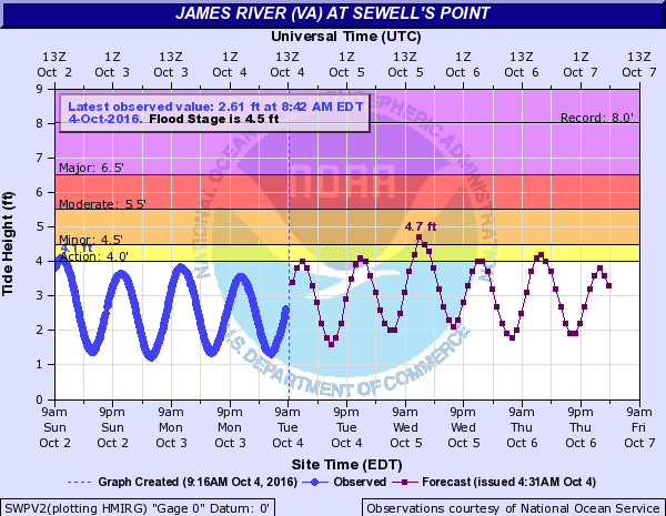
Incidentally, prior to the storm’s anticipated arrival on
Saturday, we’re looking at tidal flooding at the 4.7' mark (4.5' is minor flood stage) TOMORROW
(Wednesday) at the 12:28pm high tide (and about an hour before and after…).
Please take this time to report any actions or communicate
anticipated resource requests.
Thanks!Jim


No comments:
Post a Comment