Wednesday, April 5, 2017

Team Norfolk Severe Weather Update 4-5-17 @ 8:30pm - IMPORTANT INFORMATION

Team Norfolk,
We conducted a Team Norfolk Command and Control conference call inclusive of the National Weather Service 
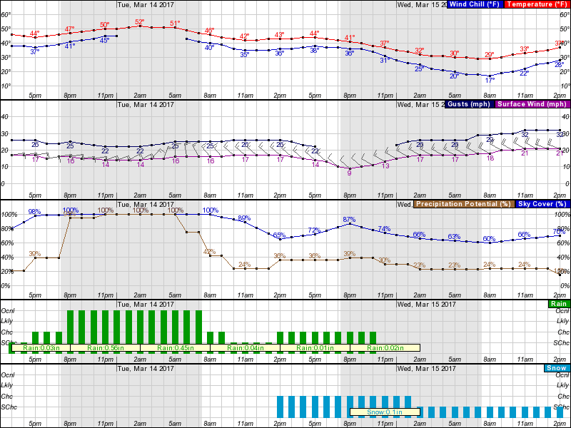
at 4:30pm, and then checked in with the NWS again shortly before 8pm.  The forecast remains unchanged, consistently pointing to severe hazardous conditions overnight and during the morning hours (approximately 7-11am).
In addition to possible tornado activity, the primary threats associated with this storm system include large hail, high/damaging winds (potentially upward of 60-75mph during thunderstorms), possible downed trees/limbs, power outages and property damage.  These forecasts have been communicated by the NWS with a high degree of confidence.  As such, protective actions are being taken now and communicated so folks have some time to plan accordingly. 
Please note: during tornado outbreaks, time is of the essence and we’re lucky if we have minutes to react.  In this situation we have received a pattern of consistent forecast information allowing us to take action now, ahead of what could possibly be a life-threatening situation. 
Interim City Manager Doug Smith declared a 10am opening for city offices.
Thursday garbage collection has been cancelled and rescheduled for Saturday.
Superintendent Dr. Melinda Boone declared a 2-hour delay for Norfolk Public Schools.
Norfolk's Emergency Operations Center will be at an elevated level of readiness with personnel on site overnight.
Again, messaging throughout the community should include the importance of registering for Norfolk Alert, to secure loose items in their yard and charge their devices ahead of any potential power outages.  Also, all official storm-related information will be posted at Norfolk.gov, the city’s social media and TV48.
Thanks and be safe!

Jim
Director, Norfolk EOC
james.redick@norfolk.gov

Team Norfolk Severe Weather Update 4-5-17 @ 3pm

Team,

Hazardous Weather Outlook For Our Area:

This Hazardous Weather Outlook is for northeast North Carolina, south central Virginia and southeast Virginia.

.DAY ONE...Today and Tonight.

Showers and thunderstorms are expected late tonight. After 3 am, some storms may contain damaging winds and large hail, with isolated tornadoes also possible.

.DAYS TWO THROUGH SEVEN...Thursday through Tuesday.

Thunderstorms are expected to continue through Thursday morning, with some storms potentially becoming strong to severe. The main threats will be from damaging winds and large hail, with isolated tornadoes also possible.

 Update from Jeff Orrock, Meteorologist in Charge with the NWS in Wakefield:

“Attached is the last briefing for the developing storm system. There have not been many changes today. Atmospheric conditions till look to support a combination of supercell thunderstorms ahead of a squall line. Some areas will experience a couple waves of showers and storms, some this evening and early tonight, but the real severe potential will be associated with the development of storms from 4 am through 11 am. [In our Norfolk area specifically, timing currently looks to be sometime between 7am and 9am]

Some areas could experience more than one round of severe storms during the morning hours on Thursday with some storms developing ahead of a larger line of storms. The primary threats look to be damaging wind and tornadoes. If a line of storms develop some larger areas of widespread wind damage are possible.

While there is still some uncertainty regarding the exact evolution of the storm system, where exactly severe weather will strike, and exactly how widespread severe weather will be, the potential impacts in some areas could be significant. 

Please keep up with forecast updates, potential Tornado Watches and all Warnings via our website, NOAA Weather Radio, local media and trusted apps. Note that cell phones in areas where Tornado Warnings are issued should alert via the Wireless Emergency Alert System.”

Team Norfolk
Again, the hourly graph is provided for your review.  As you’ll see, winds pick up tomorrow morning reaching gusts into the mid to upper 30’s in the afternoon.  Folks should be encouraged to secure loose outside items.

We have a Command and Control conference call discussion scheduled for 4:30pm; update will be shared soon after.
Emergency Operations Center will be at an elevated level of readiness with personnel on site overnight.

Community Messaging:
  • Register for Norfolk Alert.  Know how Wireless Emergency Alerts (WEA) are sent/received (info at https://www.ready.gov/alerts)
  • Secure loose items outside this evening.
  • Take cover when a Tornado Warning is received! A Warning means a tornado has been sighted or indicated by weather radar.  Appropriate shelter is the center of a small interior room on the lowest level (closet, interior hallway) away from corners, windows, doors, and outside walls. Put as many walls as possible between you and the outside. Get under a sturdy table if available and use your arms to protect your head and neck.  Have sturdy shoes with you in your shelter space.
Thanks!

Jim
Director, Norfolk EOC
james.redick@norfolk.gov


Team Norfolk - Severe Weather Update - 4-5-17 @ 10am

Ladies and Gentlemen,

Hazardous Weather Outlook from the National Weather Service:

“Showers and thunderstorms are expected late tonight. After 3 am, some storms may contain damaging winds and large hail, with isolated tornadoes also possible.

.DAYS TWO THROUGH SEVEN...Thursday through Tuesday.

Thunderstorms are expected to continue through Thursday morning, with some storms potentially becoming strong to severe. The main threats will be from damaging winds and large hail, with isolated tornadoes also possible.”

The following is provided by Mike Montefusco, Senior Meteorologist with the National Weather Service in Wakefield:

“Attached, please find the latest briefing information regarding severe weather potential tonight into Thursday morning. Overall, we're expecting an initial batch of showers and thunderstorms moving across the Coastal Carolinas this evening, potentially pushing across SE VA/NE NC this evening before midnight. This initial area of showers should be predominately sub-severe. After a brief lull in the early overnight hours, a second round of showers and thunderstorms are expected after 2am EDT tonight, with a significant severe weather threat for our area between 3 am and 10 am EDT. Please note that the tornado threat has been expanded to include Central VA and the Metro Richmond area for Thursday morning. The next briefing will be sent by 3 pm this afternoon.  Please be sure to monitor weather.gov/Wakefield for the latest information.”

I am attaching the hourly graph for your review and will provide more following the NWS 3pm update.
Thanks!

Jim
Director, Norfolk EOC
james.redick@norfolk.gov


Friday, March 17, 2017

Team Norfolk Update 3-17-17 @ 3pm - RESPONSE REQUESTED


Team Norfolk Local Emergency Planning Committee Meeting Minutes
Huge thanks again to John Roberts and Jeff Orrock for their presentations on amateur radio and tools/resources available through the National Weather Service!  Minutes and materials from the meeting are available online at http://www.norfolk.gov/Archive.aspx?AMID=119.

Upcoming Events…

Advanced SKYWARN
Team Norfolk partnership between Old Dominion University and Norfolk EOC offering this course Monday (3/20/17) at 6pm at ODU.  Details available at http://www.weather.gov/akq/skywarn.

FBI / City of Norfolk Active Threat Preparedness Event
The FBI will be hosting a community outreach event (free and open to the public) dealing with critical incidents on Saturday, April 8th, from 9 a.m. – 12 p.m. at the Norfolk Fire Training Center located at 7120 Granby Street. The mission is to establish confidence in each agencies’ skills and ability to command and control dangerous situations while educating the public on how to respond.  Registration and details available at https://www.eventbrite.com/e/active-shooter-preparedness-event-tickets-32660957804.

Team Norfolk Local Emergency Planning Committee Meeting
Scheduled for Wednesday April 19 from 1-3pm at the Norfolk Department of Public Health, the group will meet to discuss and gain awareness of various volunteer organizations who contribute significantly to response efforts.  Some traditional and some not as well known.


EXTENDED POWER OUTAGE EXERCISE – RESPONSE REQUESTED        
On Tuesday, May 2 from 9am-12:30pm, the Norfolk Emergency Operations Center will be participating in a tabletop exercise coordinated by the Virginia Department of Emergency Management (VDEM).  Without going into the details of the scenario, the outage is human-caused, widespread, and long in duration (~ 1 month).  Request for information: the exercise begins 3 days after the outage began with no signs of restoration.  As such, what are your concerns?  What resources might you be looking for?  Think about whether your facility has a generator, what it powers within your facility, fuel capacity and plans for replenishment.  Likewise, what are your information needs during such an incident?  How would you expect to receive this information?  Please send me your plans and/or thoughts at your earliest convenience so we may incorporate them into exercise play and our overarching Team Norfolk materials.  If you are interested in participating in the event, please let me know that as well! 

Naval Station Norfolk HURREX 2017
As mentioned during Wednesday’s LEPC meeting, Naval Station Norfolk will also be conducting their annual Hurricane Exercise (HURREX 2017) May 8-19.  The Navy has been gracious in allowing us here at the Norfolk EOC to play along with this exercise as well.  If your organization is interested in exercising your hurricane plans with us, please let me know and we’ll respond and otherwise communicate as if we were experiencing the incident together.  For accreditation needs / proof of exercise, I’m happy to distribute a certificate of participation to those who play.  And as we do with all exercises, we’ll conduct an After Action Report.

Thanks and have a great weekend!

Jim
Director, Norfolk EOC
james.redick@norfolk.gov

Monday, March 13, 2017

Team Norfolk Update - Impending Weather 3-13-17

Team,

Norfolk is under a Winter Wind Advisory until 10am tomorrow (Tuesday).  Additionally, the Governor has declared a State of Emergency for the Commonwealth for the impending winter storm throughout parts of Virginia.
While parts of the State may expect upward of 15" of accumulation, this should be a non-event for Norfolk.  Based on the hourly graph below, we are expected to receive rainfall possibly this afternoon and very likely overnight through the morning hours.  Rainfall amount of ~1” is expected over this 12+ hour period.  Temps overnight are in the low 50’s and sustained winds in the mid-teens w/ gusts in the low to mid 20’s.

Tuesday afternoon brings a 36% chance of snowfall.  Again, per the NWS Probabilistic Snowfall Forecast, the most likely scenario accumulation should be less than 1”; worst case is in fact 1”. 
There is no activation of the Emergency Operations Center nor recommended changes to operations.

The early morning hours of Wednesday will bring colder temperatures, with a low in the upper 20’s and wind chill in the teens.  To protect our residents experiencing homelessness, a Warming Overflow Warning (WOW) coordination call will be scheduled to discuss anticipated conditions for the week.
Lastly, if you plan to attend Wednesday’s Team Norfolk Local Emergency Planning Committee (LEPC) meeting, please RSVP with Karen Lovely at karen.lovely@norfolk.gov.  Topics will include a presentation on Severe Weather from the National Weather Service, a presentation on Amateur Radio by John Roberts and a discussion on the hurricane evacuation zone update.

Thanks!
Jim
Director, Norfolk EOC
james.redick@norfolk.gov   


Friday, March 10, 2017

Team Norfolk Update - Weekend Weather - 3-10-17 @ 3pm

Team,

Based on a 2pm conference call with the State Emergency Operations Center and the National Weather Service (NWS), the weather weekend should be uneventful.  As reported yesterday, temperatures drop and the potential for snowfall exists Sunday morning.  Accumulation probabilities are less than 1”.  Nonetheless, Norfolk Public Works are at the ready with teams on standby for the weekend.

Thanks to the amazing folks of Norfolk NEST, Human Services, NPD, CSB and Office to End Homelessness, all is set for Warming Overflow Warning (WOW) activation to ensure overnight accommodations for our residents experiencing homelessness.

The NWS reported another system expected to occur early next week causing rain Monday night into Tuesday.  Temperatures are well above freezing during this time; however, there is a chance of snowfall Tuesday evening.  This forecast is definitely subject to change with it being 72 hours out. 

Coastal flooding does not appear to be a threat with either weather system.

We’ll keep you posted on any updates.  In the meantime, feel free to monitor the NWS Probabilistic Snowfall Forecast tool and the Briefing Page.

Thanks, have a great weekend, and GO SPARTANS TONIGHT IN THE MEAC SEMIFINALS!

Jim
Director, Norfolk EOC
james.redick@norfolk.gov

Thursday, March 9, 2017

Team Norfolk - Weekend Weather 3-9-17 @ 3:50pm

Ladies and Gentlemen,

The Norfolk Emergency Operations Center (EOC) is monitoring the weather expected this weekend.  Per the hourly graph attached below, the timing of any snow suggests the morning hours of Sunday.  As for the amount, at this time, the National Weather Service's Probabilistic Snowfall Forecast shows the potential for 4”, but the likelihood of less than 1” (also provided below).  The Virginia Department of Emergency Management has scheduled a Winter Weather Conference Call tomorrow afternoon after which I will share with you any updates.
Snow or not, temperatures dip below freezing Friday night/Saturday morning with wind chills in the 20’s.  This occurs again Saturday and Sunday nights as well.  Therefore, a Warming Overflow Warning (WOW) for our residents experiencing homelessness is in effect for the weekend.  Likewise, messaging throughout the community should be to bundle up!  Infographics provided below.

Again, we’ll continue to monitor and keep you abreast of forecast changes.  In the meantime, please feel free to contact us with any questions or concerns you may have.
Separately, our monthly Team Norfolk Local Emergency Planning Committee (LEPC) scheduled for 1-3pm Wednesday the 15th will have Jeff Orrock, Meteorologist-In-Charge with the NWS in Wakefield who will be presenting on severe weather and John Roberts to discuss the critical need and capabilities of amateur radio.  Please RSVP with karen.lovely@norfolk.gov if you plan to attend.

Thanks, and GO SPARTANS AND MONARCHS!
Jim
Director, Norfolk EOC
james.redick@norfolk.gov